ASPHALT
moderate

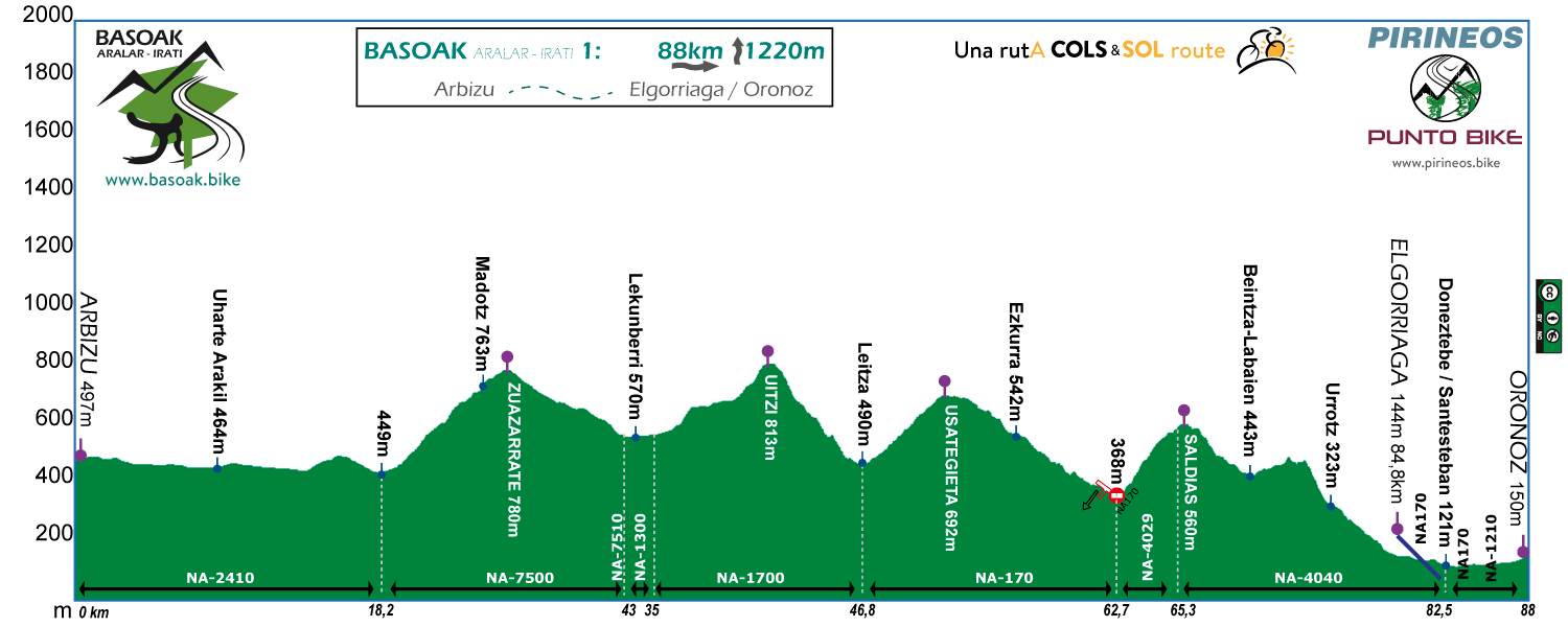
Stage 1
ARBIZU - ELGORRIAGA/ORONOZ
Distance: 88 km Unevenness: 1.220 m
Zuazarrate, Uitzi, Usategieta and Saldias. 4 moderated COLS for a moderated first day.


The first stage of BASOAK allows us to proceed on to business calmly. It is even possible, if we used the morning for the trip by car to Arbizu, to do the tour in an afternoon.
Without long stops 4 or 5 hours will be sufficient to reach Oronoz.

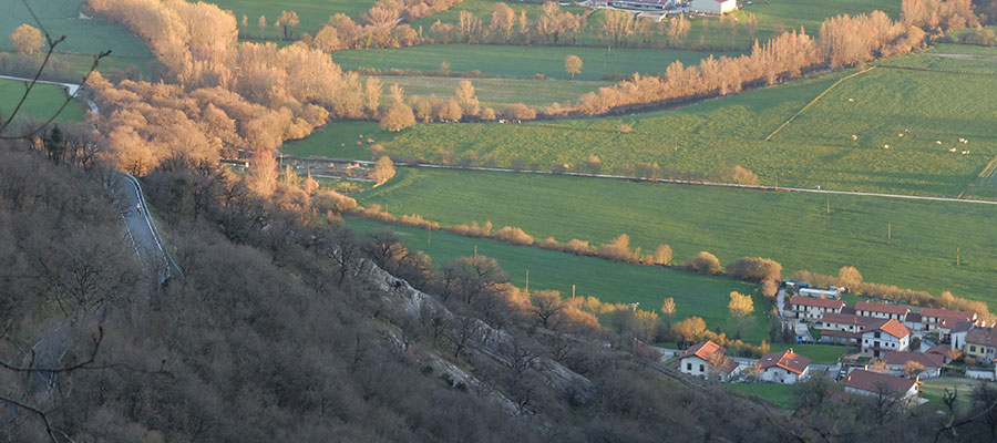
The vision of the mountain of Beriain will be a constant in our passage for La Sakana.

If we choose autumn, what will be in BASOAK will be this.

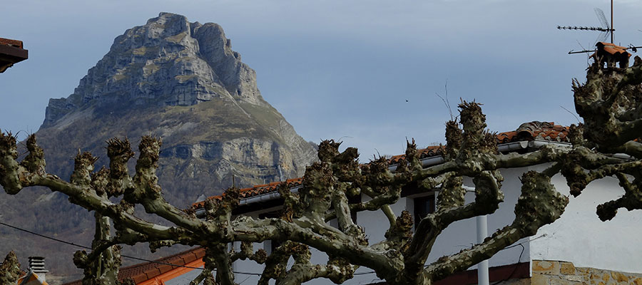
Bordering the Sierra de Aralar by its northern slope. In the image Lazkaomendi and the unmistakable Txindoki.
The first stage of BASOAK in its PLUS option goes through the secondary roads frequently used in the Classic Basque Tours, Euskal Itzulia, Ordiziako Proba, Abraham Olano, Marino Lejarreta, etc.

"Industrial" Bike Line in Tolosaldea, interesting solution bike line, BASOAK PLUS.

If we have chosen the PLUS option, we will have to tighten our teeth in the Gaintza Wall. The wall in question includes a very hard stretch of 1.6 km to 15.3%.
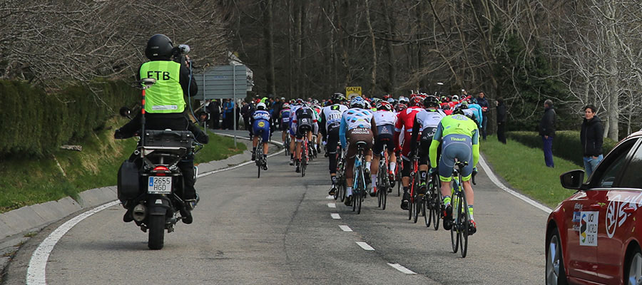
The peloton of La Euskal Itzulia 2016 crowning the top of Usategieta between Leitza and Santesteban.
in preparation
If you want to see the route on wikiloc website click on the green icon on the map
Criteria used in the 6 levels that we have chosen for the ranking of the routes:
- Walks or family routes: Routes with light slopes and little travel. Suitable for untrained family groups or for people who usually don't use the bike
- Easy: Routes with a slope that can reach 1000 meters but facing none of the large ports.
The distance will range between 40 and 60 kilometers. - Moderate: Routes with one of the "great" ports or a combination of similar difficulty. The slopes can be really important and slopes can range between 1000 and 2000 meters.
The distance will vary between 60 and 100 kilometers. - Hard: Routes with a slope ranging around 2500 meters. There may have to ascend 2 ports of the "greats" or one and several of the "minor".
The distance will vary between 90 and 130 kilometers. - Very hard:: Routes ranging from the 2500 and 4000 meters of altitude. Sometimes there may have to ascend the 3 ports of the '' greats ''.
The distance will exceed the 100 kilometers and may reach up to 200 km. - Challenge: In these times there is a public that demands "more" yet. To them arises the concept of "challenge": stages of more than a day in "non-stop" mode, 4500-5000 or even more meters of altitude routes, individual or group time trial with 3000 meters of altitude and over 100 kilometers of route.
Finally, a variety of what riders would usually call "nonsense" which to be more elegant, here we call it, 'Challenges'.
 Return
